DRONE MEDIA TURKIYE UAVTurkey.net, we provide advanced drone – based mapping and inspection services across Türkiye , supporting engineering , renewable energy , and mining projects with high-precision aerial data. By combining experienced field teams with industry-leading DJI platforms, we deliver reliable, high-resolution results tailored to your project’s technical requirements .
Advanced Drone Fleet for High-Accuracy Results
Our operations are conducted using cutting-edge DJI systems, including:
- DJI Matrice 300 RTK
- DJI Matrice 350 RTK
- DJI Matrice 4T
- DJI Matrice 3
- DJI Mavic 3M
- DJI Mavic 3T
These platforms enable us to perform:
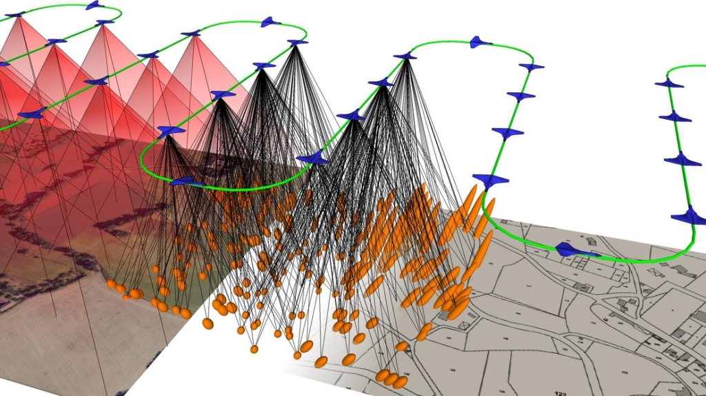
- High-resolution orthophoto production
- 3D terrain modeling
- Thermal inspections
- Multispectral analysis
- Volume and area calculations
- Industrial asset inspections
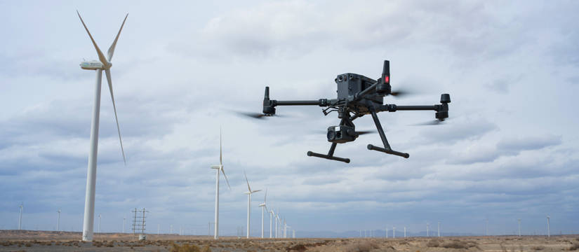
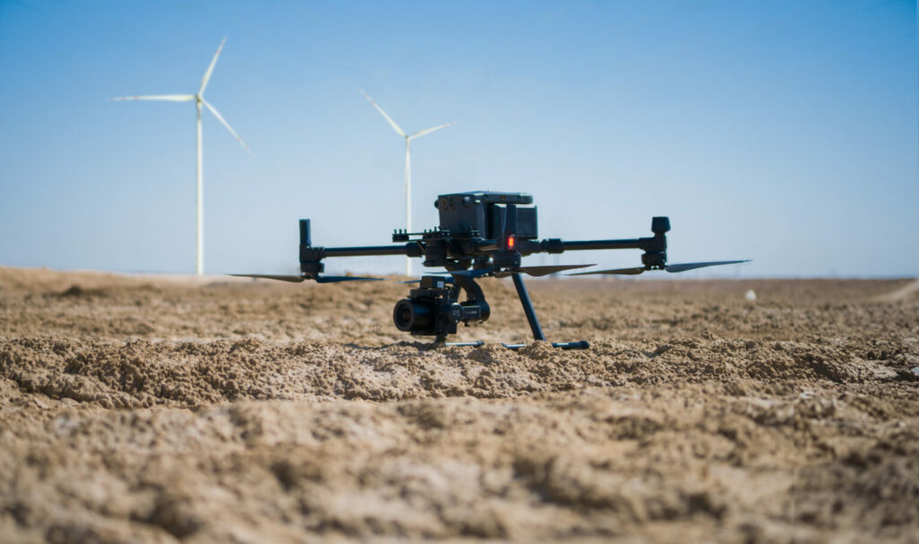
Wind Turbine Efficiency Analysis
Renewable energy investments require accurate performancee monitoring . Our drone-based inspections for wind farms provide:
- Blade surface analysis and damage detection
- Thermal inspection of components
- Structural integrity assessments
- Performance-related visual data
Using RTK-supported systems and high-resolution sensors, we help engineering teams improve operational efficiency and reduce downtime .
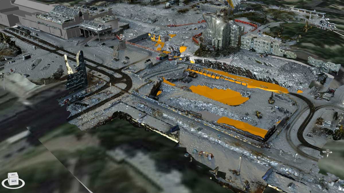
Mining Area Measurement & Volume Calculations
In mining operations, precise measurement is critical for operational planning and reporting. Our drone mapping services provide:
- Accurate stockpile volume calculations
- Excavation progress tracking
- Site boundary measurements
- Digital elevation models (DEM)
- Orthomosaic mapping
High-resolution imagery ensures centimeter-level accuracy, enabling reliable reporting and decision-making.
How Our Process Works
We have developed a structured, transparent workflow to ensure smooth project execution:
1. Define Your Technical Requirements
You specify:
- Desired resolution (GSD level)
- Requested file format (Orthophoto, DEM, Point Cloud, CAD, etc.)
- Preferred drone platform
- Proposed operation dates
2. Send the Project Area (.KML File)
You determine the area in Google Earth and send us the .kml file.
3. Airspace & Compliance Check
Our team evaluates the location and checks for:
- Restricted or military zones
- Residential limitations
- Conflicting air traffic
- Regulatory flight permissions
We ensure full compliance with Turkish aviation regulations before scheduling operations.
4. Cost Calculation & Proposal
We prepare a detailed financial breakdown including:
- Commercial flight permits
- Travel and accommodation (if required)
- Operational costs based on project scope
You receive a proforma invoice valid for 15 days.
5. Contract & Scheduling
Once the price is approved:
- A detailed service agreement is signed
- 50% advance payment is received
- Official flight permissions are processed
- Operation dates are secured
6. Field Operation
On the scheduled date, our certified team mobilizes to the project site and conducts the aerial operation efficiently and safely.
During the operation, we share live location updates and field visuals confirming that the project has started.
7. Data Delivery
Upon project completion:
- All requested outputs are delivered in the specified format
- Transfer is completed via your preferred delivery channel
After delivery, the remaining 50% balance payment is processed.
Why Choose UAVTurkey?
- Nationwide drone operations across Türkiye
- Enterprise-level DJI equipment
- High-resolution, engineering-grade outputs
- Regulatory compliance & flight authorization management
- Transparent pricing and structured workflow
- Experienced field and data-processing teams
Our Experience
We have successfully collaborated with numerous engineering, energy, and industrial companies. You can review the companies we have worked with by visiting the “Clients” section under “About Us” on our website.
Clients – UAV TURKEY
Let’s Elevate Your Project
Whether you are managing a wind energy facility, operating a mining site, or conducting large-scale engineering work, UAVTurkey provides the aerial precision and professional workflow your project demands.
Contact us today to discuss your project and receive your customized proposal.