Advanced Drone Solutions for Mapping, Surveying & Industrial Applications
With the rapid advancement of technology, unmanned aerial vehicles (UAVs) have become indispensable tools across many industries — and the mapping and geospatial sector is no exception.
At UAV TURKEY DRONE MEDIA, we offer cutting-edge drone systems and services tailored to high-precision mapping, LiDAR, industrial inspections, and scientific research. Whether you need centimeter-level accuracy or multispectral insights, our drone fleet and experienced operators are ready to deliver.
📍 Our Drone Fleet – Precision Meets Performance
We offer a curated selection of industry-leading drone platforms, ensuring performance, reliability, and compliance with all local aviation regulations:
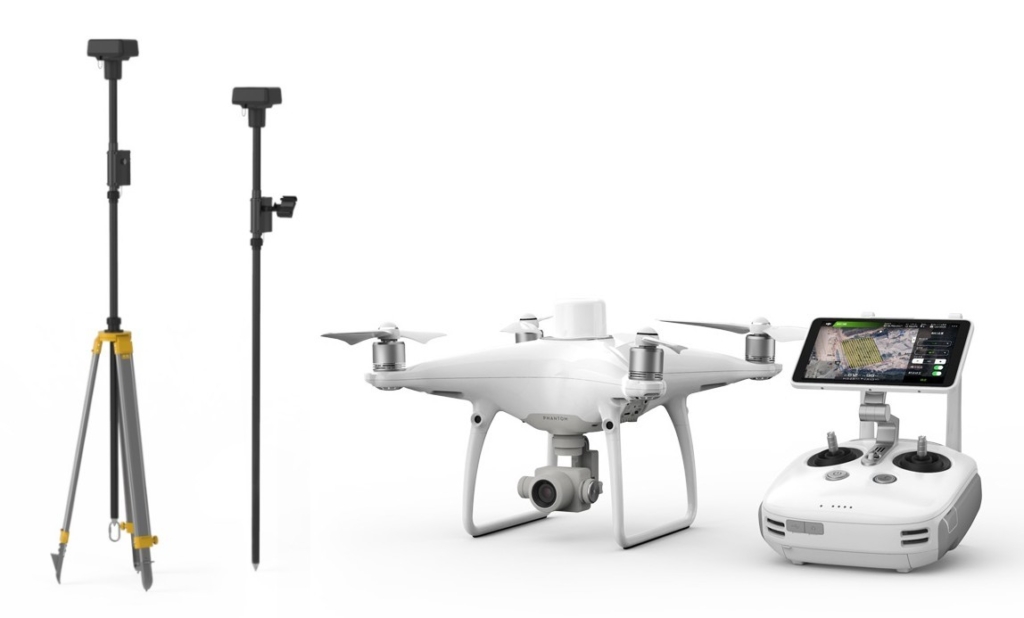
🚁 DJI Phantom 4 RTK
-
Built for surveying with centimeter-level accuracy
-
Ideal for projects with minimal ground control point requirements
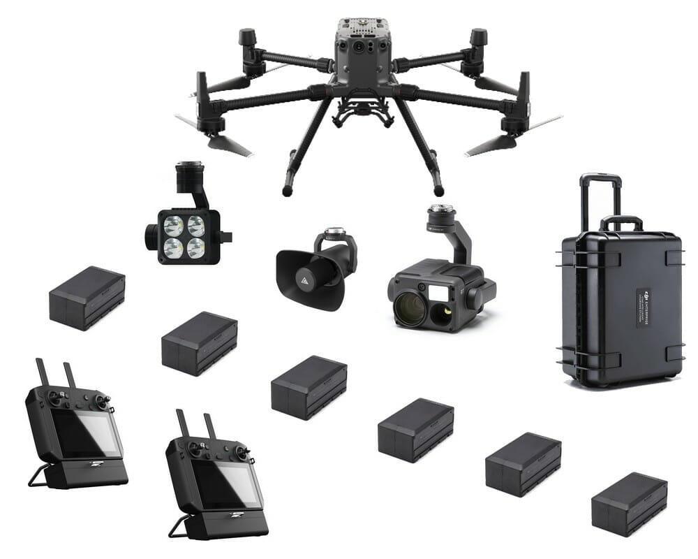
🚁 DJI Matrice 300 RTK
-
Supports multiple payloads (LiDAR, thermal, zoom, RGB)
-
Perfect for complex industrial, utility, and topographic mapping missions
🚁 DJI Mavic 3 RTK / Mavic 4 RTK
-
Lightweight, compact, yet extremely precise RTK drones
-
Ideal for rapid deployment in urban or rural mapping projects
🚁 DJI Mavic Multispectral
-
Integrated multispectral sensors for vegetation and crop health analysis
-
Optimized for agricultural research and environmental monitoring
🚁 Autel EVO II Pro RTK & Autel Enterprise Drones
-
High-resolution sensors, modular payloads, and fast flight times
-
Suited for gas leak detection, infrastructure inspections, and 3D modeling
🔍 Application Areas
Our drones are used in a wide variety of technical and commercial fields:
-
🗺️ Mapping & Surveying: Topographical surveys, infrastructure planning, construction sites
-
🏭 Industrial Inspections: Factories, pipelines, storage tanks, and high-risk structures
-
🪨 Mining & Quarrying: Stockpile volume calculations, exploration planning, safety inspections
-
📡 LiDAR Scanning: 3D terrain and infrastructure modeling with high-density point clouds
-
🌾 Agricultural Research: Multispectral plant health analysis and NDVI indexing
-
🔥 Gas Leak Detection: Drone-mounted sensors for environmental and industrial safety
-
🧪 Scientific & Environmental Research: Site analysis, erosion tracking, and land use studies
💬 Need Help Choosing the Right System?
Our expert consultants are here to help you select the most suitable drone and payload combination for your project needs. Whether you’re a geospatial professional, mining engineer, or industrial planner — we provide turnkey solutions that include:
-
✈️ Licensed drone operators
-
🗂️ Legal permits and flight planning
-
🔧 Equipment sales and training
-
🔁 Data processing & 3D modeling services
🛰️ Let’s Elevate Your Project
Whether you’re operating in Turkey, the Balkans, or beyond — UAV TURKEY DRONE MEDIA is ready to support your next mapping or inspection project with state-of-the-art drones and expert service.
📞 Contact us today to get a custom quote or drone recommendation.